"Geologic Map of the Lake George Region" by David H. Newland and Henry Vaughan
 

Historic Maps


Preview

image preview

Date

1939

Description

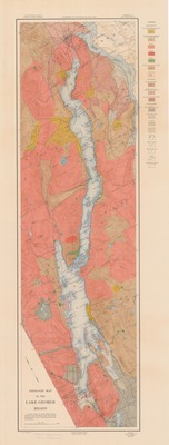
Geologic Map of the Lake George Region. Topographic map scale 1:62,500. University of the State of New York, New York State Museum, 1939. Print.

Physical Location

Map Case 0001 Drawer 0002 Folder 0007

Physical Description

16 x 42 inches.

Source

Union College Adirondack Research Library

Plum Print visual indicator of research metrics
PlumX Metrics
  • Usage
    • Abstract Views: 222
    • Downloads: 111
  • Social Media
    • Shares, Likes & Comments: 11
see details

Share

Image Location

 
COinS


BESbswy
BESbswy