


Historic Maps
Preview
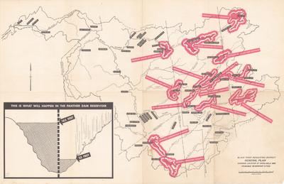
Date
1945
Description
Black River Regulating District. General Plan Showing Available and Feasible Reservoir Sites. Physical map of the Black River, scale 1" = 2.5 mi. Albany, NY: Black River Regulating District. Print.
Physical Location
Map Case 0002 Drawer 0012 Folder 0003
Physical Description
35 x 23 inches.
Source
Union College Adirondack Research Library