


Historic Maps
Preview
Date
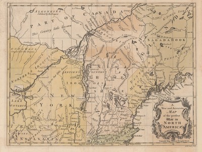
1757
Description
Map showing the North American theater of the Seven Years' War, known in the Americas as the French and Indian War. Printed by Universal Mag. J. Hinton, Newgate Street. Shows location of Native American nations and colonial borders in the Atlantic Northeast. Relief shown pictorially.
Physical Description
10.5 x 14 inches.
Source
Welch Collection (Private)