


Historic Maps
Preview
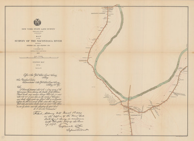
Date
1897
Description
Map of the Survey of the Sacandaga River Between Station 335 and Station 484 Series 2 No.6. Topographic map, scale 1:10,000. Albany, NY: New York State Land Survey, 1897. Print.
Physical Location
Map Case 0002 Drawer 0013 Folder 0001
Physical Description
30 x 22 inches.
Source
Union College Adirondack Research Library