


Historic Maps
Title
Preview
Date
2020
Description
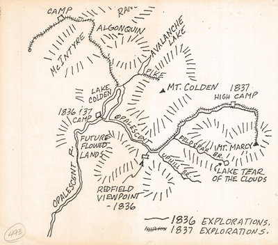
Hand-drawn map showing explorations in the High Peaks in 1836 and 1837. Print. Undated.
Physical Location
Map Case 0001 Drawer 0006 Folder 0003
Physical Description
10 x 8.5 inches
Source
Union College Adirondack Research Library