


Historic Maps
Preview
Date
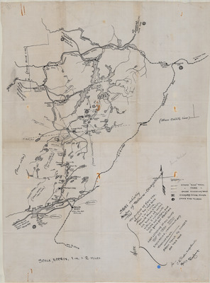
1919
Description
Sketch Indicating Location of Red Horse-Oswegatchie Trail. Sketched map with notations, scale 1" = 2 mi. 1919. Print.
Physical Location
Map Case 0001 Drawer 0006 Folder 0003
Physical Description
16 x 21 inches.
Source
Union College Adirondack Research Library