


Historic Maps
Preview
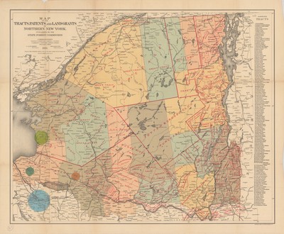
Date
1893
Contributor Names
Julius Bien & Company
Description
Color map published by the State Forest Commission as part of the atlas of New York, published by Julius Bien & Co. Lists individual tracts of land as originally found within the park.
Physical Location
Map Case 0002 Drawer 0013 Folder 0001
Physical Description
26.5 X 21.5 inches.
Source
Union College Adirondack Research Library