


Historic Maps
Preview
Date
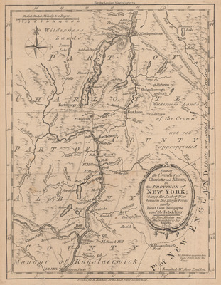
1778
Description
Print from the London Magazine 1778. Relief shown pictorially. Shows forts and roads from Albany to Ticonderoga. Scale ca. 1:575,000.
Physical Description
11 x 8.25 inches.
Source
Welch Collection (Private)