


Historic Maps
Preview
Date
1844
Description
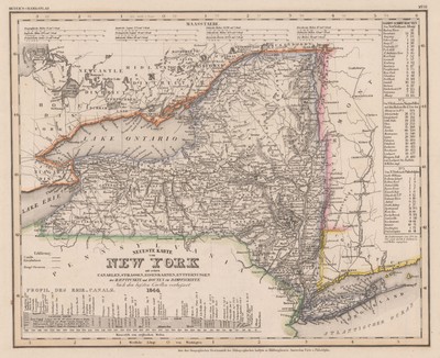
Meyer's Hand atlas No.52 of New York State. Map is in German and consists of canals, streets, railroads, and distances that are hand painted. Included is the profile of the Erie Canal along the bottom as well as steam ship routes between cities on the right. Printed by the Geographischen Graviranstalt des Bibliographischen Instituts zu Hildburghausen.
Physical Description
18 x 15.5 inches.
Source
Welch Collection (Private)