


Historic Maps
Preview
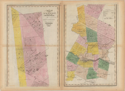
Date
1839
Description
Burr, David H. Map of the County of Herkimer. Physical map of Herkimer County, hand-painted, scale 1 in.= 2.5 mi. Ithaca, NY: Stone & Clark, 1839. Print.
Physical Location
Map Case 0002 Drawer 0013 Folder 0003
Physical Description
26.5 x 19 inches.
Source
Union College Adirondack Research Library