


Historic Maps
Preview
Date
1873
Description
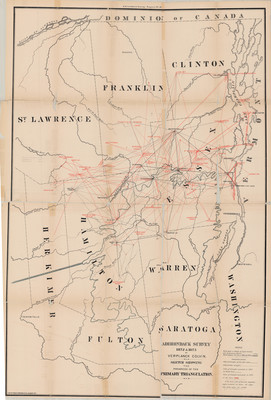
Sketch Showing the Progress of the Primary Triangulation Plate 19. Map. Albany, NY: Adirondack Survey, 1873. Print.
Source: Union College Adirondack Research Library
Physical Location
Map Case 0002 Drawer 0014 Folder 0005
Physical Description
23 x 34 inches.
Source
Union College Adirondack Research Library