


Historic Maps
Preview
Date
1891
Description
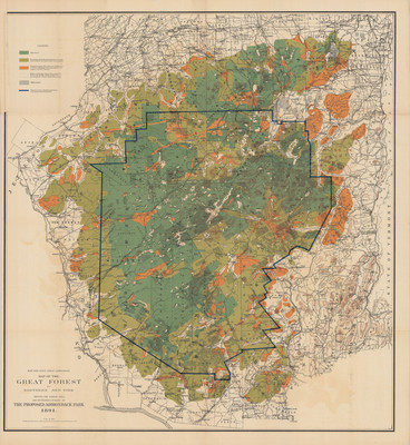
New York State Forest Commission. Map of the Great Forest of Northern New York Showing the Forest Area and Boundaries (in Blue) of the Proposed Adirondack Park. Land use map, scale 1" = approx. 9 mi. Albany, NY: New York State Forest Commission, 1891. Print.
Physical Location
Map Case 0002 Drawer 0011 Folder 0002
Physical Description
29 x 31.5 inches.
Source
Union College Adirondack Research Library