


Historic Maps
Preview
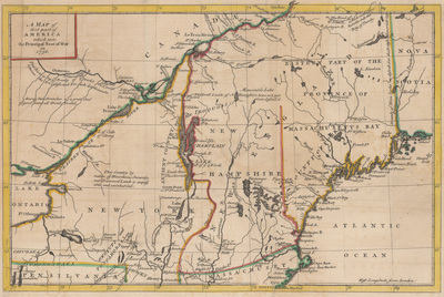
Date
1756
Description
Map showing the geographic extent of the French and Indian War. Covers northern New England and upper Saint Lawrence Valley. Does not show military positions, movements, or fortifications. Relief shown pictorially. Includes notes.
Physical Description
8.5 x 13 inches.
Source
Welch Collection (Private)